
Culture & History
A Legacy of Diversity
When it was a perennial river, the Gila created verdant valleys all along its banks. The riverine landscape was populated with tall cottonwoods and mesquite groves, as well as a kaleidoscope of aquatic and terrestrial wildlife.
People also massed along this stretch of the Gila, where they could take advantage of reliable water and fertile soils. They cultivated fields of corn, beans, and melons, and later they would also grow wheat.
Recent archaeological surveys have documented year-round settlement and floodwater farming beginning as early as 675 CE. There is archaeological evidence of people being in the region going back to about 13,000 BCE.
One of the many aspects that makes the Great Bend special is that, even in its deepest history, it bears evidence of being a place of cultural overlap, fusion, and diversity. From the end of the Pleistocene era, there are artifacts of a southern California tradition among Clovis materials. Fast-forward a bit in time, and there are artifacts from a Mojave Desert tradition among artifacts from a tradition associated with the Sonoran and Chihuahuan Deserts.
Fast-forward again to the 1100s. Those year-round farming settlements bear evidence that people associated with the Hohokam archaeological tradition were interacting regularly with people associated with the Patayan archaeological tradition, in some cases even living together as neighbors. (Each of those archaeological traditions also encompasses multiple cultural and ethnic identities.) And their Piipaash and O’odham descendants lived together in many villages in the Great Bend. This was the case when Jesuit missionary Eusebio Kino drew a map depicting the villages in 1695.
Many of the settlements Kino mapped were revisited by Jacobo Sedelmayr in the 1740s, and again by various members of the Anza expedition in the 1770s. These villages were in place for a century or more, over multiple generations.
At some point before the encounter with Kino, some ancestral Piipaash had begun migrating upstream toward the Akimel O’Odham in the middle Gila River valley. Between 1825 and 1830, in response to intertribal conflict, the last of the Piipaash residing in the Great Bend took refuge among their Akimel O’Odham allies. Around that same time, the Xalychidom, cultural kin and close allies of the lower Gila River Piipaash, also left their homeland on the lower Colorado River for safety among the Piipaash and Akimel O’Odham.
Consequently, the Great Bend was nearly void of communities when the United States military arrived in 1846, leaving a false impression of a landscape that actually has substantial Indigenous residential history.
Whose Land Is This?
Most of the Great Bend’s archaeology attests to Patayan and Hohokam cultural and agrarian traditions (ancestral Yuman and ancestral O’odham, respectively). These were contemporaneous yet contrasting ways of life that overlapped in the region. Over time, those customs merged and diversified, ultimately becoming the Indigenous traditions that continue today. At least 13 federally recognized Tribes have cultural, historical, and ancestral ties to the Great Bend of the Gila. These ties live on through oral and written history, story, song, ceremony, pilgrimage, and other traditions and ways of knowing.
In addition to living and farming in the Great Bend, people have used the Gila River valley as a travel corridor for millennia. Several ancient and significant Indigenous trails cross this terrain. With the coming of colonialists, the valley also became an overland route between Spanish settlements in Sonora and missions along the California coast. Father Eusebio Kino blazed this trail in the late 1699, and Juan Bautista de Anza formalized it in 1775.
The Anza Trail served as the foundation for many subsequent transcontinental trails and roads, including Kearny’s trail for the Army of the West, Cooke’s Wagon Road for the Mormon Battalion, and the Butterfield Overland Stage Line. Stage stations and Euro-American settler communities began springing up along these routes in the 1860s. One of these, Stanwix Ranch, was the site of the westernmost skirmish of the Civil War.
The settlers brought ranching, commercial farming, and mining. Many families in the towns of Buckeye, Arlington, and Gila Bend are their descendants. These communities also have traditional connections to the Great Bend of the Gila.
The Respect Great Bend coalition seeks permanent protections for existing federal lands. In that sense, these are public lands that will belong to all of us in perpetuity. Therefore, we urge you to reflect on the deep history of the Great Bend. It is important to acknowledge that places and routes in the Great Bend also represent the harmful and painful legacy of what colonization and America’s westward expansion meant for the Indigenous communities whose homelands these are. It’s time to recognize this complicated history by listening to Tribes, honoring their connections to this land, protecting the Great Bend, and following Tribes’ preferences for this landscape’s management.
Help Us Protect This History
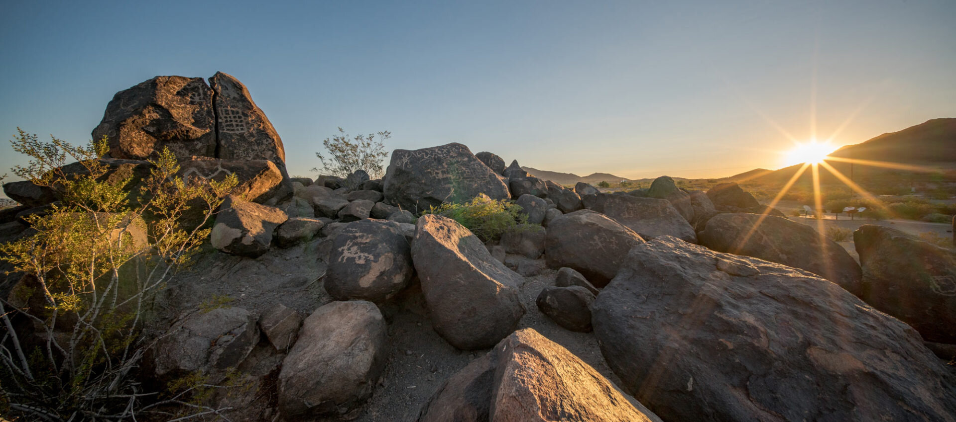
Signs of the Great Bend’s deep and meaningful history—petroglyphs, geoglyphs, settlements, trails—lay bare for all to see. But this visibility is also a vulnerability, and these places are constantly threatened with vandalism, defacement, and outright destruction.
This is why we need your help to protect the significant history of this special place.
Banner image: Paul Vanderveen
Learn more about the cultural history of this special place:
The Great Bend of the Gila: A Nationally Significant Cultural Landscape
by Aaron M. Wright, Pat H. Stein, Barnaby V. Lewis, and William H. DoelleThe Great Bend of the Gila: Contemporary Native American Connections to an Ancestral Landscape
by Aaron M. Wright and Maren P. Hopkins